

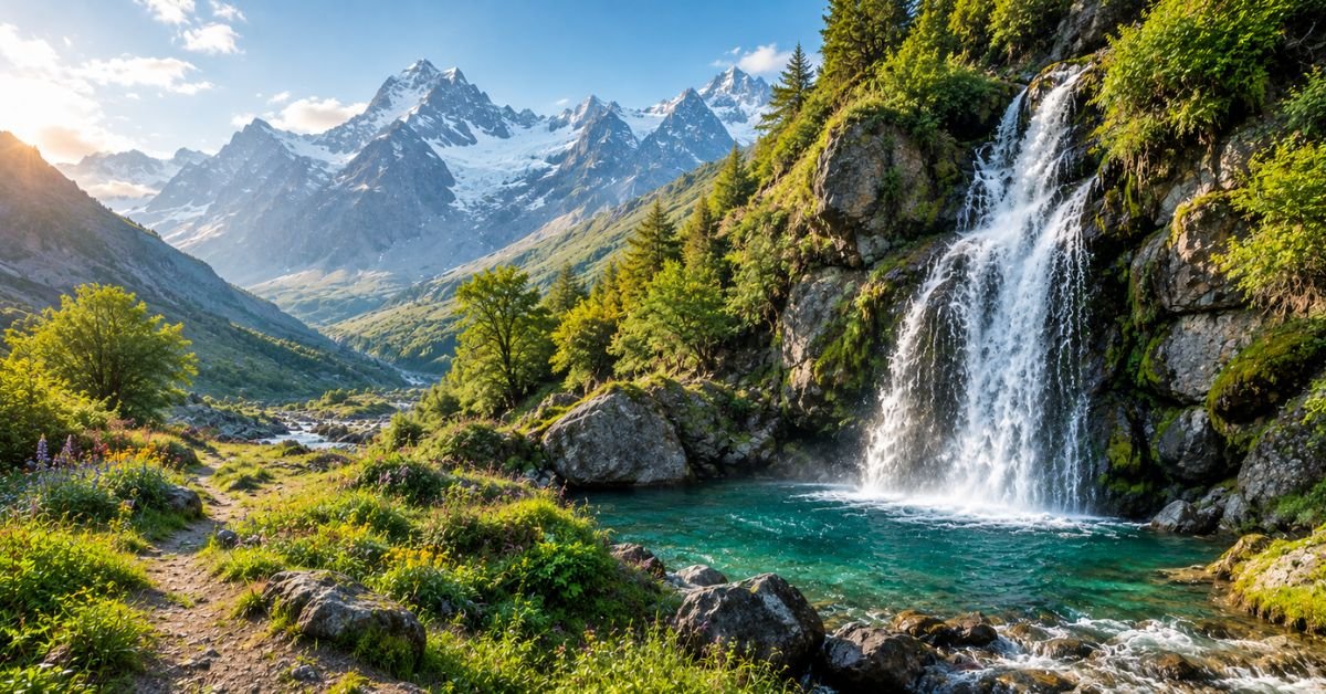
Imagine following a quiet mountain road until the sound of rushing water rises above the wind. Beyond an orchard, a narrow footpath leads through wildflowers, and suddenly a waterfall appears between towering cliffs. There are no souvenir stalls, no tour buses, and perhaps only a few birds calling from the trees.
Learning how to find hidden waterfalls is about discovering places like this without putting yourself, local communities, or fragile landscapes at risk. The best discoveries rarely come from blindly following social media pins. They come from studying maps, researching reliable information, asking residents thoughtful questions, and knowing when a trail is unsafe.
Pakistan’s northern regions offer an inspiring starting pointManthokha and Khamosh in Kharmang District are two of Gilgit-Baltistan’s stunning waterfalls. Around Hunza, smaller streams and seasonal cascades reward curious travelers who explore responsibly with local advice.
This guide explains how to research lesser-known waterfalls, choose the right season, plan an achievable route, budget realistically, and capture memorable photographs. These techniques also work in forests, tropical highlands, and mountain regions around the world.
At-a-Glance Travel Summary

- Best time: Spring through early autumn, depending on rainfall, snowmelt, and trail conditions.
- Duration of deal: One day for a waterfall accessible by vehicle; three to five days for an exploration of the region.
- Estimated daily budget: PKR 6,000–12,000, approximately $21–43, for a modest independent trip in Pakistan, excluding international flights.
- Difficulty: Easy roadside viewpoints to strenuous, unmarked mountain paths.
- Travel style: Scenic drives, short hikes, village stays, photography, and peaceful exploration.
- Best approach: Research beforehand, confirm access locally, and hire a qualified guide for unfamiliar terrain.
Costs depend on exchange rates, accommodation availability, transport arrangements, and group size. International visitors should maintain a contingency fund for delays and unexpected overnight stays.
How to Find Hidden Waterfalls Using Local Research
1. Read the Landscape Before Opening Your Map
Waterfalls form where water encounters a steep change in elevation. Look for contour lines that crowd together, narrow valleys, stream junctions, and sudden drops along mountain channels. Satellite imagery may reveal exposed rock faces, forest corridors, and potential routes leading toward a gorge.
Topographic maps are especially useful because they show elevation and terrain that ordinary road maps omit. Google Maps can help with initial orientation, while Google Earth and offline hiking maps provide a closer view of surrounding slopes.
Satellite imagery cannot confirm that a path is public, stable, or passable.. A route that appears to lead directly to a waterfall might end at a cliff, private property, or dangerous river crossing.
2. Search Beyond Popular Tourist Lists
Use specific search combinations rather than simply typing “best waterfalls.” Try phrases such as “seasonal waterfall near a village,” “local hiking trail in the valley,” and “mountain stream viewpoint.”
Travel blogs, community tourism websites, regional trekking groups, and recent photographs can reveal useful leads. Check publication dates carefully. A trail described as accessible several years ago may now be blocked by landslides, construction, or erosion.
For Pakistan, research established waterfalls around Skardu and Kharmang, then investigate surrounding valleys through reliable local contacts. Cross-check location names and directions rather than assuming every photograph online represents a real, publicly accessible destination.
3. Ask Residents Specific Questions
Local knowledge can be more valuable than an impressive photograph. Speak with guesthouse owners, experienced guides, drivers, village tourism committees, and shopkeepers who regularly travel nearby.
Instead of asking, “Where is a secret waterfall?”If the trail is affected by recent rains, find out whether it flows year-round, whether visitors can walk there, and how long the approach takes.
Ask about river crossings, livestock paths, private orchards, and customary restrictions.Before departing, determine the guiding fee, transport costs, and return time.An honest guide should not promise an effortless adventure but rather discuss hazards honestly..
4. Verify the Route Before Leaving
Make an offline map, mark the trailhead, and record the contact information for your accommodation. Someone who is not joining the hike should know your intended route and return time.
Check recent weather forecasts, road notices, and local guidance on the morning of departure. If the route is unfamiliar, choose a guide with experience in that particular valley.
A waterfall is never worth risking a serious fall, a sudden flood, or a night stranded on a mountain.
The Golden Route: Exploring Skardu and Hunza
Start in Skardu
Skardu makes a practical base for exploring Baltistan’s landscapes. Depending on your starting point, reach the town by domestic flight or overland transport, allowing extra time for weather-related disruptions.
Spend your first day arranging transport, checking conditions, and speaking with local guides. This preparation helps you avoid wasting daylight searching for an unverified trail.
On the following day, consider Manthokha Waterfall in Kharmang District. It is a recognised regional attraction, commonly described as approximately 80 kilometres from Skardu, with a cascade around 55 metres high. Driving time varies with road conditions, traffic, and stops, so confirm the current route locally.
The approach is primarily a road excursion rather than a demanding wilderness trek. Its surroundings, flowing water, and mountain scenery make it an excellent place to study seasonal water levels and practise landscape photography.
Look Beyond the Main Viewpoint
Kharmang is also associated with Khamosh Waterfall. Ask a knowledgeable local guide whether nearby cascades are accessible during your visit and whether reaching them requires a separate hike.
Do not assume every waterfall has a maintained footpath, public access, toilets, or food stalls. Confirm these details before leaving Skardu, and carry sufficient drinking water and food for the entire outing.
Keep the day flexible. A late start, unexpected road closure, or afternoon storm can make a second destination impractical.
Continue Toward Hunza
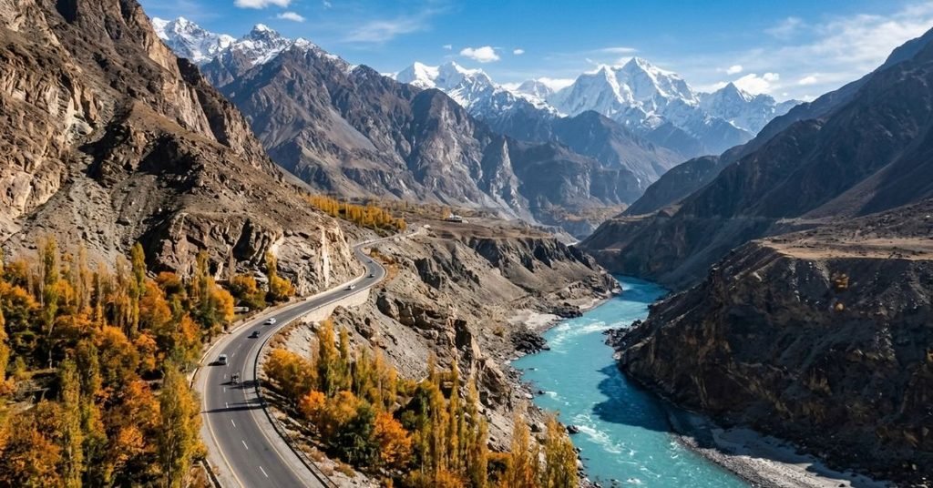
Hunza offers a different landscape: cultivated terraces, stone villages, glaciers, and towering Karakoram peaks. The Karakoram Highway connects communities throughout the region, but long driving distances and weather disruptions make rushed itineraries uncomfortable.
Allow at least two or three days to explore the Hunza area after reaching it. Base yourself near Karimabad or Upper Hunza according to your planned activities, then ask residents about seasonal cascades and streamside walks.
Passu and Ghulkin provide useful starting points for exploring Upper Hunza. Their surroundings include glaciers, mountain slopes, and traditional settlements, but a nearby stream should not automatically be treated as a safe waterfall trail.
A responsible route connects verified locations rather than chasing every unconfirmed map pin. Return to your accommodation before dark, and abandon any trail that requires scrambling beside unstable cliffs or crossing fast water.
Where to Stay: Hotels and Accommodation
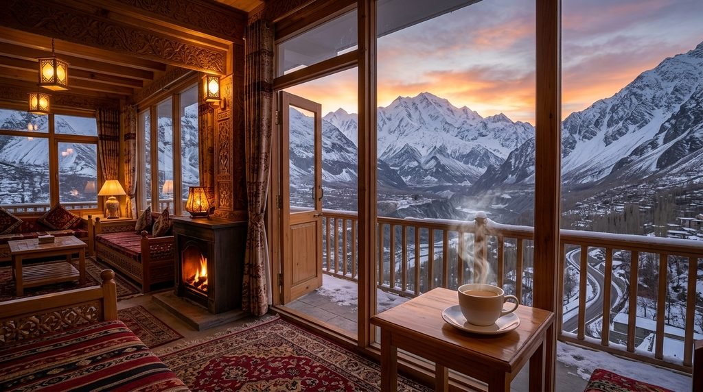
Your accommodation should make early starts, changing weather, and transport arrangements easier.
- Budget or backpacker option: Look for established guesthouses in Skardu town or Hunza villages. Shared facilities and simple rooms can reduce costs while keeping you near shops and transport. Ask about hot water, heating, breakfast times, and whether staff can arrange a reputable guide.
- Mid-range or boutique option: Choose a small hotel with reliable transport assistance, comfortable bedding, mountain views, and a flexible breakfast arrangement. A property near your intended trailhead may be more valuable than one with elaborate decorations.
- Luxury or distinctive stay: Consider a well-reviewed resort or heritage property with private rooms, on-site dining, and assistance arranging local excursions. In remote areas, verify whether electricity, heating, Wi-Fi, and hot water operate consistently.
Accommodation options are available near Manthokha, but availability, room standards, and prices are subject to change. Confirm the total price, taxes, meals, and cancellation terms directly with the property before reserving.
Consider the walking routes you intend to take rather than assuming every Hunza property offers convenient access to remote streams.
Local Culinary Scene and Must-Try Eats
Waterfall exploration is more enjoyable when meals reflect the region you are visiting. In Baltistan, try traditional dishes such as mamtu, steamed dumplings commonly filled with meat, and hearty noodle dishes suited to cool mountain weather.
In Hunza, seek out chapshuro, a baked pastry filled with seasoned meat, alongside local breads, apricots, walnuts, and other seasonal produce. There is a wide range of menus and preparations between households and restaurants, so make sure to ask about the ingredients before ordering.
For a hiking lunch, pack bread, nuts, fruit, and other food that travels well. Carry enough water for the entire outing rather than assuming every stream is safe to drink.Mountain water can contain harmful microorganisms if it is not treated.
Village restaurants may serve meals only during particular hours. Confirm availability before beginning a long excursion, especially outside the main summer travel season.
Dress modestly when visiting villages, ask permission before photographing residents, and respect private homes, orchards, religious spaces, and cultivated land. Urdu and English are useful in many tourist-facing settings, while Balti, Shina, and Burushaski are among the regional languages. A friendly greeting and a request for permission can make interactions more welcoming.
Essential Logistics: Getting There and Around
Flights, Buses, and Private Transport
For Skardu, compare available domestic flights with overland journeys from Islamabad.In addition to saving time, flights are susceptible to weather disruptions. Road travel offers changing scenery and flexibility, although journeys can be long and mountain roads demanding.
For Hunza, travellers commonly use the Karakoram Highway from Gilgit or approach overland from farther south. Shared transport may cost less than hiring a private vehicle, but departure times, luggage space, and stops can be less flexible.
A private driver is useful for remote waterfall excursions because the driver can wait while you hike and adapt the schedule to changing conditionsIn advance, confirm the vehicle type, fuel costs, waiting time, and return arrangements.
Weather, Roads, and Connectivity
May through September is generally a practical planning window for many accessible northern Pakistan excursions, but exact conditions vary with elevation. Spring snowmelt can increase water flow, while heavy rainfall and intense mountain storms may cause flash floods, landslides, and road closures.
Check local weather forecasts and road advisories before every major drive. Ask your accommodation or guide about recent flooding, unstable slopes, and whether the intended trail is currently accessible.
Mobile coverage and Wi-Fi vary considerably between settlements and remote valleys. Download maps, accommodation confirmations, and emergency contacts before leaving town. Ask your accommodation which mobile networks work in your intended area.
International visitors should check Pakistan’s official visa requirements for their nationality before booking flights. Entry procedures and documentation requirements may differ according to passport, travel purpose, and current regulations.
Carry Pakistani rupees for small purchases and rural transport. Card acceptance and cash access can be limited away from larger towns. Check your home country’s plug compatibility with local sockets, and bring a suitable adapter and charging bank.
Insider Tips, Costs, and Tourist Traps to Avoid
Pack for Wet, Uneven Terrain
Your footwear matters more than fashionable hiking clothes. Wear hiking shoes with reliable grip, and carry a lightweight waterproof jacket, spare socks, sun protection, a first-aid kit, and a charged phone.
A walking pole can help on loose gravel. Keep your hands free when negotiating uneven ground, and never climb wet rocks to reach a better photograph.
For remote trails, carry a headlamp, emergency food, sufficient drinking water, and warm layers. Mountain weather can change rapidly, even when the morning begins with clear skies.
Understand Waterfall Safety
Never assume a shallow-looking pool is safe for swimming. Cold water can trigger shock, submerged rocks can cause serious injuries, and strong currents may be difficult to recognise from the bank.
Avoid stepping behind a cascade unless an experienced local guide confirms the route is safe. Stay away from overhanging cliffs, unstable ledges, and riverbanks during heavy rain. If the water suddenly becomes muddy, rises, or carries branches, move to higher ground immediately.
Do not enter a gorge during thunderstorms or when upstream rainfall threatens a flash flood.
Photograph Without Damaging the Landscape
Arrive early for softer light, fewer visitors, and quieter surroundings. Use a tripod on stable ground, protect your camera from spray, and experiment with a fast shutter speed to capture individual droplets.
A slower shutter can create silky water, but only attempt longer exposures from a secure position. Avoid stepping into fragile vegetation or blocking other visitors’ access.
Estimate Your Expenses
- Simple guesthouse: PKR 3,000–7,000, approximately $11–25 per night.
- Basic meals per day: PKR 1,000–2,500, approximately $4–9.
- Shared local transport: PKR 1,000–3,000, approximately $4–11.
- Private vehicle excursion: PKR 8,000–18,000, approximately $29–64.
- Local guide: Agree on the fee beforehand.
These are indicative budgeting ranges, not verified current tariffs. Exchange rates, season, group size, and negotiated arrangements affect the final amount. Confirm entrance charges and guide fees locally; do not assume every waterfall charges an admission fee.
Save money by sharing transport, staying several nights in one base, and booking directly with reputable accommodation providers. Avoid unlicensed operators who cannot explain the route or safety arrangements.
Compare Seasons Before Booking
Spring: Snowmelt and fresh greenery can make landscapes attractive, but mornings may be cold and unpredictable.
Summer: Longer days and accessible routes make exploration easier, although crowds, heat at lower elevations, and storms remain possible.
Autumn: Clear views and quieter trails can be appealing, but water flow may decrease at some waterfalls.
Winter: Snow-covered scenery can be beautiful, but ice, closures, and difficult travel conditions may make remote waterfalls inaccessible.
The best season depends on the waterfall’s elevation, water source, and local weather. Check current conditions rather than relying on a general seasonal calendar.
Final Thoughts on Finding Hidden Waterfalls
The most rewarding waterfall adventures begin with curiosity and end with good judgement. A promising map, a conversation with a local resident, and a carefully planned walking route can reveal beautiful places that hurried travellers overlook.
In Skardu and Hunza, rushing streams and mountain scenery offer countless reasons to slow down, observe the landscape, and appreciate the communities that live beside it. The same approach works wherever water carves a path through forests, hills, or rugged highlands.
Research carefully, travel with respect, and turn back whenever conditions become unsafe. A hidden waterfall is worth discovering, but the finest adventure is one that leaves you with wonderful memories and leaves the landscape undisturbed.
Frequently Asked Questions
1. How do I find hidden waterfalls near me?
Search topographic maps, recent hiking reports, community walking groups, and local tourism information. Contact residents or qualified guides to verify access, trail conditions, and water hazards before setting out.
2. Are hidden waterfalls always difficult to reach?
No. Some lie beside public roads, while others require steep hikes or travel through remote terrain. Check the route’s elevation, distance, surface, and estimated return time before choosing a destination.
3. What is a good waterfall to visit near Skardu?
Manthokha Waterfall in Kharmang District is a recognised option for travellers exploring the Skardu region. Confirm current road conditions and allow extra time for the excursion.
4. Can I explore waterfalls without hiring a guide?
You may visit accessible, clearly marked public viewpoints independently. For unmarked trails, unfamiliar river crossings, or remote mountain terrain, an experienced local guide is the safer choice.
5. What should I wear for waterfall hiking?
Choose grippy hiking shoes, moisture-managing layers, and a waterproof outer layer. Carry spare socks and avoid ordinary sandals on slippery or uneven trails.
6. Is swimming safe beneath a waterfall?
Not necessarily. Cold temperatures, hidden rocks, powerful currents, and sudden changes in water levels can make swimming dangerous. Follow local restrictions and stay out of the water when conditions are uncertain.
7. How can I discover waterfalls without crowds?
Travel outside peak visiting hours, research less-publicised public trails, and ask residents about suitable alternatives. Respect private land and avoid publicising precise locations when doing so could damage a fragile habitat.
